Drone UXO Survey
What are the benefits of drone based magnetometry surveys?
Non intrusive detection method: No energy is transmitted from the sensor it is passive detection only.
Reduced areas of contact with the site: The onsite team does not necessarily need to walk on the ground to conduct the survey.
Survey Accuracy: We are using survey grade equipment to capture location information to provide you with data you can trust.
Access those impossible areas: Intertidal mud and marsh are flown over with ease.
Increased speed of survey: The drone covers ground faster than traditional approaches to magnetometry data capture.
Size of survey area: We have completed surveys of areas upto 70Ha in size and linear surveys of upto 9km in length.
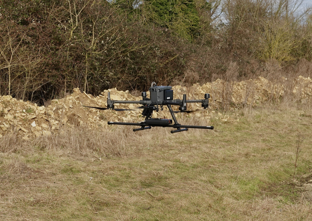
The Sensor Platform
Based on the results of your UXO desk top study we can advise if our platform is appropriate for your situation. If you have not completed a study we can arrange for one to be completed for you.
This drone is a customised DJI M300 which has a radar system to enable the drone to accurately fly as low as 100cm from the ground and carry a magnetometer. The primary use of this drone is in the detection of UXO in difficult to access areas, but it can be used in other applications: archaeology and ground characterisation.
The M300 is also equipped with survey grade RTK gps system to deliver accurate surveys.
Establishing quality
For a UXO drone survey to be useful it needs to be accurate and you need to verify its efficacy on site. Appropriate surrogates need to be used in a test area to confirm they can be identified by the magnetometer in this site context. The location needs to be accurately measured with a survey grade GNSS and this compared with the data collected from the drone. This process is key to a survey you can trust.
In addition it is critically important to calibrate the flight plan (speed, height above ground) to the target and terrain. Flying higher makes avoiding vegetation easier, too high and critical targets will disappear. Flying faster makes the survey quicker but noise will increase and the speed needs to work with the sensor sample rate and target types for the survey

Processing the data
After capturing the data we complete initial processing to remove residual noise from the drone. Following an initial quality check the data is packaged and provided to your UXO consultant or our geophysicist can process the data and we can commission a UXO consultant, appropriate to your needs, for you.
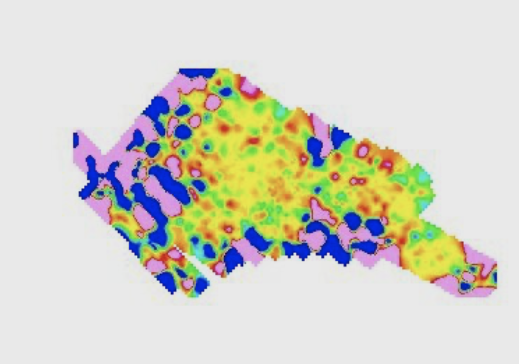
The image to the right is a relatively small survey completed in central London in an area that was bombed during WWII. It shows a number of possible UXO targets and also some areas of steel re-enforced concrete.
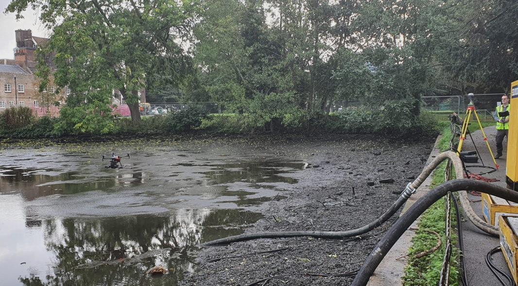
Access all areas
One of the key advantages of a drone based survey is that areas that are practically impossible to access using other methods become possible. In the image to the left the area could not be walked over safely but the drone flew over it with ease.
It is also important to note that even some areas, like peat bogs for example, can in theory be accessed using tracked vehicles but this is very much slower than using the drone to complete the survey.
Have questions or need assistance?
MAILING LIST SUBSCRIPTION
Join our mailing list for important industry updates and news. We’ll never sell or share your email address, and you can unsubscribe at any time.